The final leg of our four-week journey found us crossing the border between Belize and Guatemala in a region known as the Peten, where the flat Yucatan Peninsula begins to rise into the Guatemalan Highlands. Our first stop was Tikal, perhaps the most impressive Mayan ruin in all of Meso-America. Then it was on to the Guatemalan Highlands for a two-week stay in a small village along the shores of Lake Atitlan. Here, we had a front row seat for the line of subduction along the Central American trench.
The entrance station
Tikal National Park. Declared a Park in 1955 and a World Heritage Site in 1979, Tikal also serves as a Biosphere Reserve protecting native forest in an increasingly populated country. The Park contains 222 square miles (or 142,000 acres) of pristine forest.
Helen stands beneath a giant Ceiba tree, seen as we entered the site. These grand guardians were once logged extensively for their lumber but are now protected.
Within the central 6 square miles of the site over 3,000 buildings have been mapped. The site is quite extensive!
Many doorways have the original wood lintels still intact.
All of the buildings that are photogenic have been excavated from the jungle and are partially restored. The main buildings at Tikal are from the Maya's Classic Period, and extend from about 90 to 869 AD. That a list of Mayan rulers in Tikal with their dates of reign can be known is an astounding thought! See the list
here.
This is Temple I or the Temple of the Grand Jaguar, situated on the Great Plaza.
We climbed Temple II (the Temple of the Masks) to get this view back toward Temple I. I was here for the first time in 1977 and again in 1986.
A modern Mayan ceremony at the base of Temple I. The local Maya still consider the site sacred.
View of Temple I from the north. This temple is approximately 165 high.
We also climbed Temple IV, the highest of all the temples at nearly 200 feet above the jungle floor! In this view to the east, we can see the last of the great temples built, Temple III (right), Temple II in the middle and Temple I on the left behind Temple II. In 1977, we happened to be visiting during a full moon and the ruins were opened to visitors where we got an excellent view from this perch.
From Temple IV looking northeast into the vast Peten jungle. Don't miss Tikal if you happen to be in the area.
The nearest town to Tikal is Flores, located on a small island in the Lake Peten-Itza.
A causeway links the island with the mainland.
Picturesque homes on the shores of Lake Peten-Itza.
The tuk-tuk is a convenient and inexpensive way to get around in Guatemala. Brought to Central America from southeast Asia, they are now everywhere in this part of the world. They originated in Japan and were exported to Thailand since 1934. They went out of use in Japan in the 1960's.
Narrow, hilly street in Flores.
A celebration was happening in Flores on the night of our visit and many townspeople were out enjoying the festivities. We flew to Guatemala City the next morning and then took a shuttle to Lake Atitlan.
Our first view of the lake on January 8, just after a cold front from the north had cleared the air to provide a fantastic view.
As we took in the view from the mirador (lookout), we had no idea that we were looking right out to the small village we would be staying in.
Late afternoon sun a Lake Atitlan.
After arriving at our lakeside villa, we saw the sun descend over the San Pedro volcano.
To the south are the twin volcanoes of Tolimán (right) and Atitlan (left). They last erupted in the 1850's and are stunning examples of strato-volcanoes. These features are located in a line extending from near Puerto Vallarta, Mexico to South America. The line of volcanoes form as a slab of ocean crust is being shoved under Central America. When the slab reaches depths of between 60 and 100 miles, it begins to melt and blobs of magma rise upwards to erupt lava. The line of volcanoes on the surface delineates where the slab achieves these depths.
This is a photo by Don W. on his way back to Guatemala City on January 27. It is of the Fuego (Fire) volcano erupting. To see a recent report on the ongoing eruption from Fuego,
see this link from the Smithsonian Global Volcanism project. Subduction!
San Pedro volcano at sunrise on our first morning at Casa Colibrí.
We took a two mile walk north to the next village of San Antonio.
The church at San Antonio.
I just loved the blue color of the
huipiles and textiles at San Antonio.
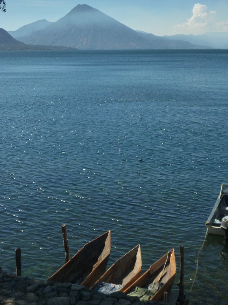
Traditional wooden fishing boats at dock in San Antonio.
Helen enjoys a quiet moment at our pool overlooking the lake.
We visited another pueblo on the lake, San Juan de La Laguna. This village has hundreds of murals on the walls of buildings. We also visited a textile cooperative where many things were purchased. Visit the home page of the San Juan de La Laguna web site
here.
The old and the new - they kept the façade of the old church after it was destroyed in an earthquake. There has been a church in this village since at least 1633 (first recorded).
On our day lake tour we next visited Santiago de Atitlan, a more bustling village. Here two women sell their fruit on the street market.
Peppers, peppers, everywhere!
Another Lake Atitlan street scent in the village of Santiago de Atitlan.
Another town, San Lucas de Tolimán, is rarely entered by visitors but we told our 18 year old captain to take us there. Here some high school girls react to our clowning with them.
Don W. gives them a high-five, which they love.
Panajachel street scene. I remember Panajachel from my trip in 1978 and recall a restaurant where all the hippies gathered - maybe it was called the Blue Bird? Anyway,, for an interesting read about Lake Atitlan,
see this New York travel article by Joyce Maynard.
Here is a 1991 NYT article that explains a bit about the mid-70's in Pana.
Textiles, textiles, textiles. Guatemala is a land of textiles!
We took a day trip to the village of Chichicastenango where the Thursday market is the largest in all of Central America. I was amazed at the color and the vitality present in the streets that day. Here, women sell fresh-cut flowers on the steps of the church.
Buying tomatoes at an indoor portion of the Thursday market.
One of the last things attempted in our two-week stay was a hike up the inner slope of the caldera wall. We started out at the church in Santa Catarina Palopó and saw the "streets" of the pueblo.
Climbing about the town, we knew wee would get great views across the lake.
San Pedro volcano was covered in cloud this morning but the surface of the lake was quite calm.
Reflections of clouds on the lake.
Santa Catarina Palopó on Lake Atitlan.
Onion field above Santa Catarina Palopó. They grow lots of them here at the lake.
One day, we'll have to come back here in the rainy season and see everything green!
At the top of the caldera we could look south toward San Lucas Tolimán (left) and San Juan de La Laguna and Santiago de Atitlan (right). What a view!
Enjoying refreshments at the top of the hike - about 4 miles.
Our final morning dawned clear toward the twin volcanoes of Tolimán and Atitlan. For a summary of the eruptive history of these two volcanos, see these links
here and
here from the Smithsonian Global Volcanism web site.
Sunrise on San Pedro volcano on our last morning at the lake. This volcano was a great symbol of strength for us during our stay at the Casa Colibrí.
Sunset on Lake Atitlan. Thank you for reading.